- Infrastructure
- Mobility


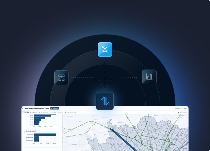
Flow provides ridership and on-time performance for each line and station. Flow is empowering operational planners at transit agencies to make better, data-driven decisions.
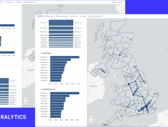
Matrix provides zone-to-zone mobility demand broken down by mode of transport. Matrix is the most reliable input for local transit plans and transport models.
The most innovative companies and authorities use Teralytics' products to make mobility more efficient, reliable and sustainable.

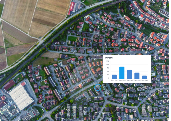
Service optimization: Adjust frequencies, modify routes, or introduce new services based on actual travel patterns, improving efficiency and customer satisfaction. Ridership Forecasting: Forecast demand accurately and optimize service schedules, ensuring better resource allocation and reducing operational costs.
Customer insights: Gain a deeper understanding of your customer’s needs, identify areas for improvement, and tailor your operations accordingly, including adjusting ticket pricing.
Partnership opportunities: Share Teralytics’ insights with external partners, such as urban planners, researchers, or app developers, and foster collaboration and innovation.
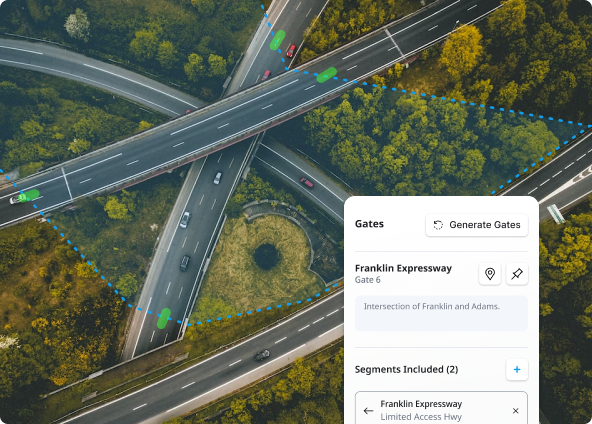
Planning and design: Design and optimize transportation networks, determine the location of new infrastructure and make informed decisions on transportation investments.
Demand management: Develop targeted measures such as congestion pricing, parking management, or incentives for using alternative transportation modes.
Transit planning and operations: Analyze data on ridership, travel patterns, and service utilization to optimize transit routes, frequencies, and schedules.
Infrastructure investment decisions: Identify locations where additional lanes, intersections, or public transportation facilities are needed to enhance capacity and improve overall system efficiency.
Evaluation and policy development: Support evidence-based evaluation of transportation policies and initiatives. Assess the impact of new bike lanes, pedestrian infrastructure, or transit improvements.
Calibration and validation: Use actual travel data to refine model parameters and ensure that the model accurately represents real world travel behavior.
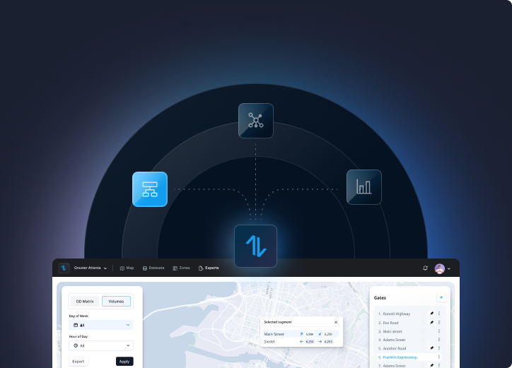
Out of the Box Sub-Area Analysis: Select a subarea, and export origin-destination matrices of that area. Easily integrate these data into your favorite modeling and simulation tools.
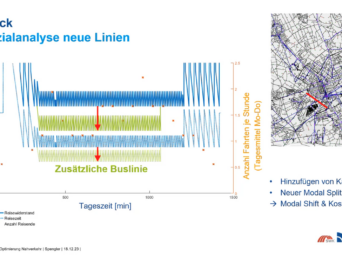
Scenario analysis: evaluate the effectiveness of different interventions, estimate changes in travel behavior, and anticipate the consequences of proposed changes using actual travel data.
Data-driven insights: Understand better the factors influencing travel choices, identify travel patterns across different demographics or geographical areas, and uncover emerging transportation trends to develop more nuanced and realistic models that reflect the complexities of travel behavior.